 PIG-PIB Katalog metadanych eCUDO.pl
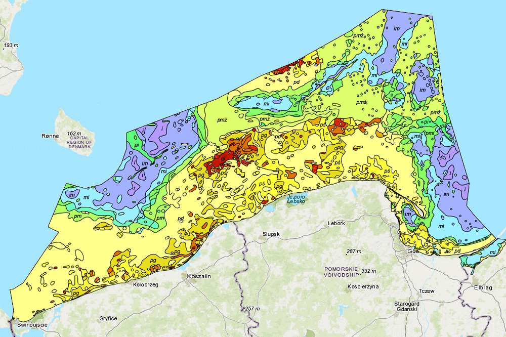
Geological map of the Baltic Sea - sediments according to Shepard
Mapa geologiczna Bałtyku - osady według Sheparda
The data present surface sediments of the bottom of Polish maritime areas according to Shepard classification
Dane przedstawiają osady powierzchniowe dna polskich obszarów morskich według klasyfikacji Sheparda
Simple
-
Data (Publikacja)Date (Publication)
- 2007-06-01
-
IdentyfikatorIdentifier
- urn:SDN:CDI:pgi.gov.pl:uuid:73e621d9-5889-432b-97e8-e395f38e437c
-
StatusStatus
-
ZakończonyCompleted
-
GEMET - INSPIRE themes, version 1.0
GEMET - tematy INSPIRE, wersja 1.0
-
-
Geology
Geologia
-
Map chart
Mapa
- Marine geology
-
-
SeaVoX Platform CategoriesKategorie platform SeaVoX
-
- research vessel
-
Continents, countries, sea regions of the world.
-
-
Baltic Sea
-
-
Use limitation
-
no conditions apply
-
Ograniczenia dostępuAccess constraints
-
Prawa autorskieCopyright
-
Typ reprezentacji przestrzennejSpatial representation type
-
WektorVector
-
OdległośćDistance
- 100 m
-
JęzykMetadata language
- English
-
Zbiór znakówCharacter set
-
Utf8UTF8
-
Kategoria tematycznaTopic category
-
-
ŚrodowiskoEnvironment
-
GeoinformacjaGeoscientific information
-
))
- Begin date
- 2007-01-01T23:00:00
- End date
- 2007-01-09T23:00:00
-
Unikalny identyfikator zasobuUnique resource identifier
-
43264326
- Codespace
-
SeaDataNet
-
Format dystrybucjiDistribution format
-
-
WMSWMS
(
1.3.0
)
-
WMSWMS
(
1.3.0
)
-
Zasób sieciowyOnLine resource
-
0
(
OGC:WMS-1.3.0-http-get-map
)
Lithological map of the Baltic Sea (according to Shepard)
Klasyfikacja osadów powierzchniowych wg Sheparda
-
Zasób sieciowyOnLine resource
-
11
(
OGC:WMS-1.3.0-http-get-map
)
Sediments in the ground
Osady w podłożu
-
PoziomHierarchy level
-
Zbiór danychDataset
Wynik zgodności
Conformance result
-
Data (Publikacja)Date (Publication)
- 2010-12-08
-
Explanation
-
See the referenced specification
-
AprobataPass
- Yes
Wynik zgodności
Conformance result
-
Data (Publikacja)Date (Publication)
- 2008-12-04
-
Explanation
-
See the referenced specification
-
AprobataPass
- Yes
Wynik zgodności
Conformance result
-
Data (Publikacja)Date (Publication)
- 2014-07-23
-
Explanation
-
See the referenced specification
-
AprobataPass
- Yes
Wynik zgodności
Conformance result
-
Data (Publikacja)Date (Publication)
- 2016-06-20
-
Explanation
-
See the referenced specification
-
AprobataPass
- Yes
-
StatementOświadczenie
-
This data was obtained with an use of all known scientific standards.
Dane te uzyskano z wykorzystaniem wszystkich znanych standardów naukowych.
-
Identyfikator plikuFile identifier
- c66a51c8-6024-456b-9e80-e199663fff97 XML
-
JęzykMetadata language
- English
-
Zbiór znakówCharacter set
-
Utf8UTF8
-
Poziom hierarchiiHierarchy level
-
Zbiór danychDataset
-
Nazwa poziomu hierarchiiHierarchy level name
-
CDICDI
-
Oznaczenie daty metadanychDate stamp
- 2022-03-01T13:43:29
- Metadata standard name
-
ISO 19115/SeaDataNet profile
- Metadata standard version
-
1.0
Overviews
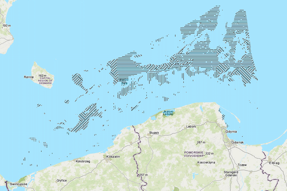
Spatial extent
Provided by
