 PIG-PIB Katalog metadanych eCUDO.pl
Marine geology
Type of resources
Available actions
Topics
INSPIRE themes
Keywords
Contact for the resource
Provided by
Formats
Representation types
status
Resolution
specificationTitles
-

The data present surface sediments of the bottom of Polish maritime areas according to Folk classification
-
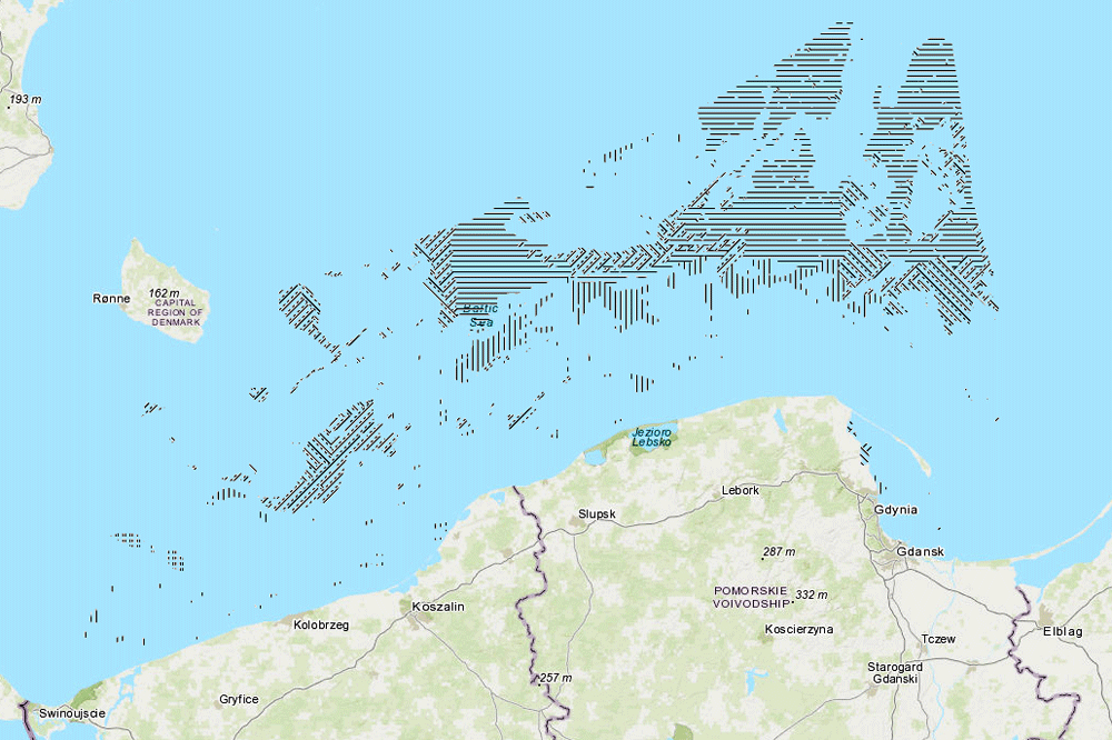
The data present surface sediments of the bottom of Polish maritime areas according to Shepard classification
-
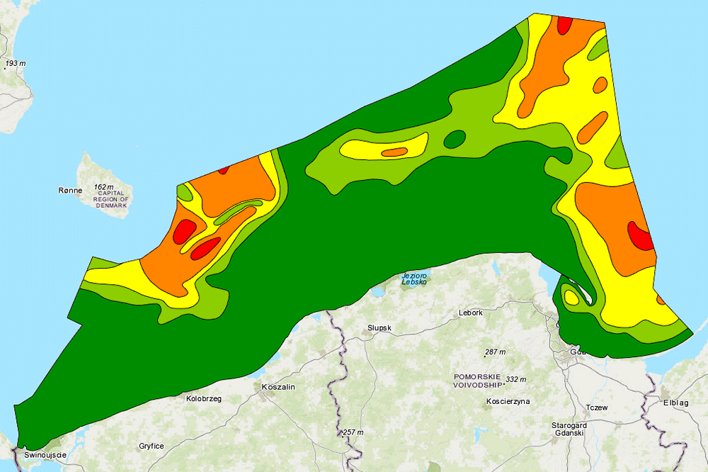
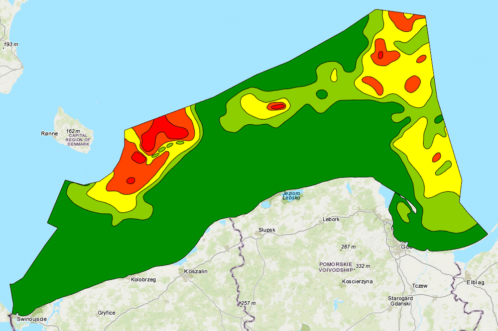
The data present the content of elements in the sediments of the bottom of Polish maritime areas
-
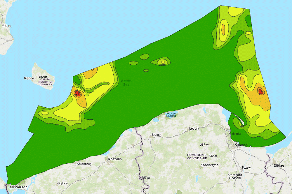
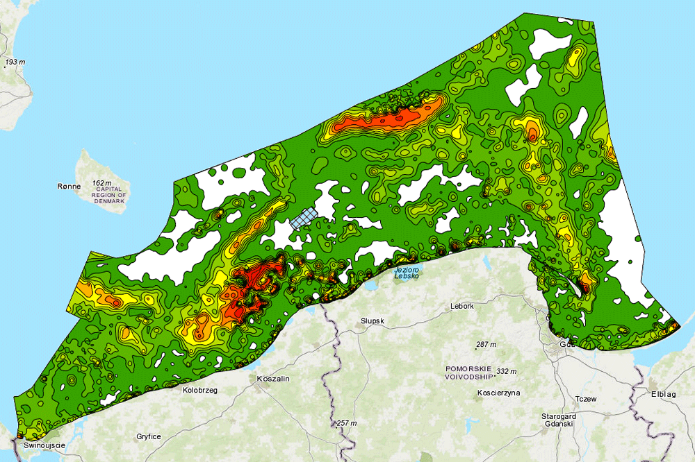
The data present the content of elements in the sediments of the bottom of Polish maritime areas
-
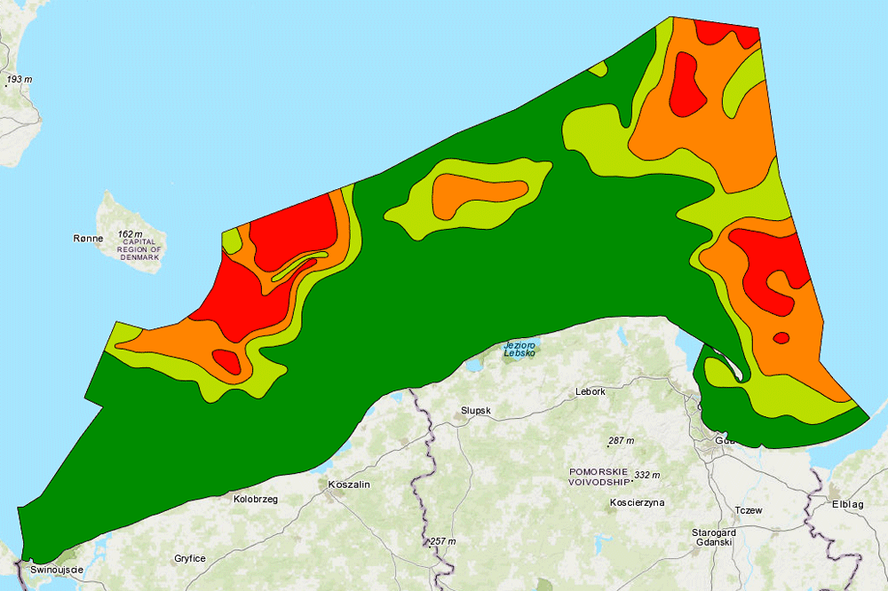
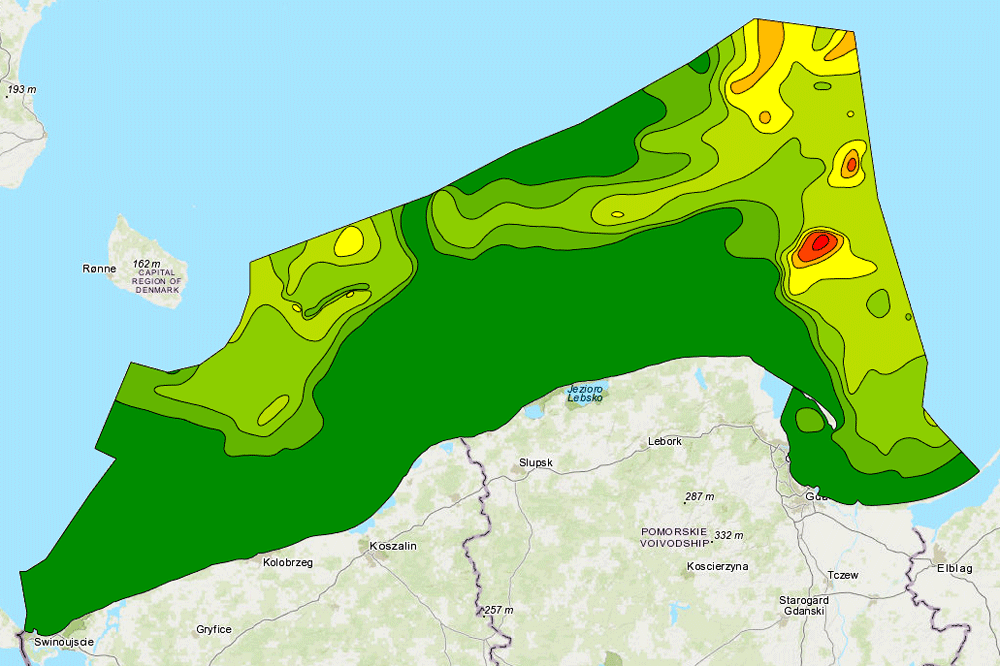
The data present the content of elements in the sediments of the bottom of Polish maritime areas
-
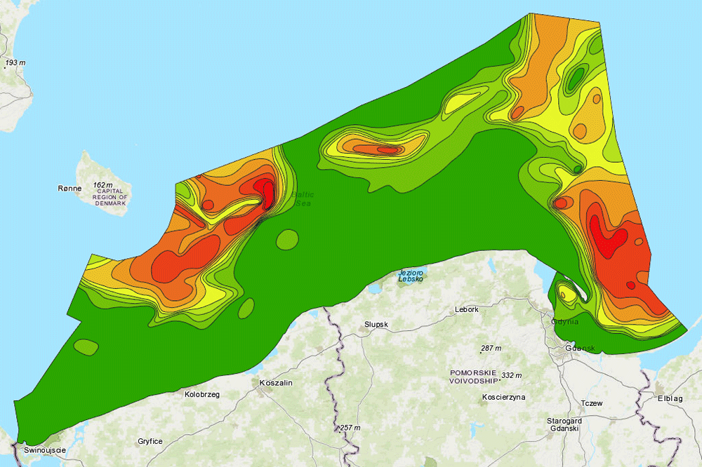
The data present the content of elements in the sediments of the bottom of Polish maritime areas
-
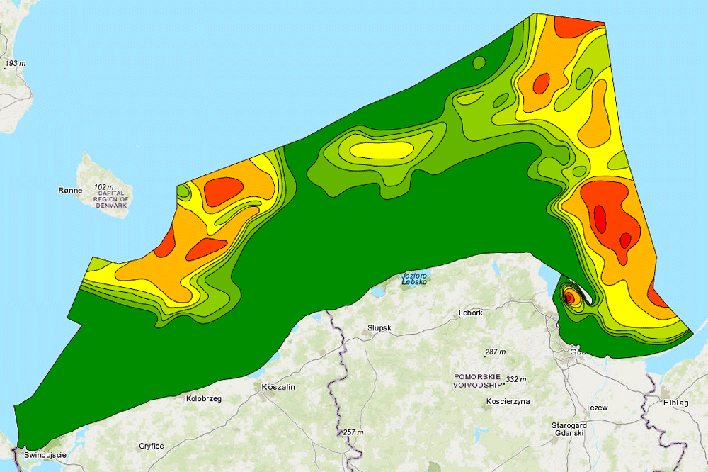
The map shows the percentage of fractions 0,063-0,125 mm at the bottom of the Baltic Sea. The map is part of the "Atlas of lithological parameters of the Baltic Sea sediments".
-
The data present the content of elements in the sediments of the bottom of Polish maritime areas
-
The data present the content of elements in the sediments of the bottom of Polish maritime areas
-
The data present the content of elements in the sediments of the bottom of Polish maritime areas